How to Grow a Lake
To the unsuspecting resident, Lake Minnetonka looks similar to any of the other 10,000+ Minnesota bodies. However, upon closer inspection, there are things that make Minnetonka somewhat unique among the state’s vast selection of lakes. Let’s take a look at the major factors that led to its formation!
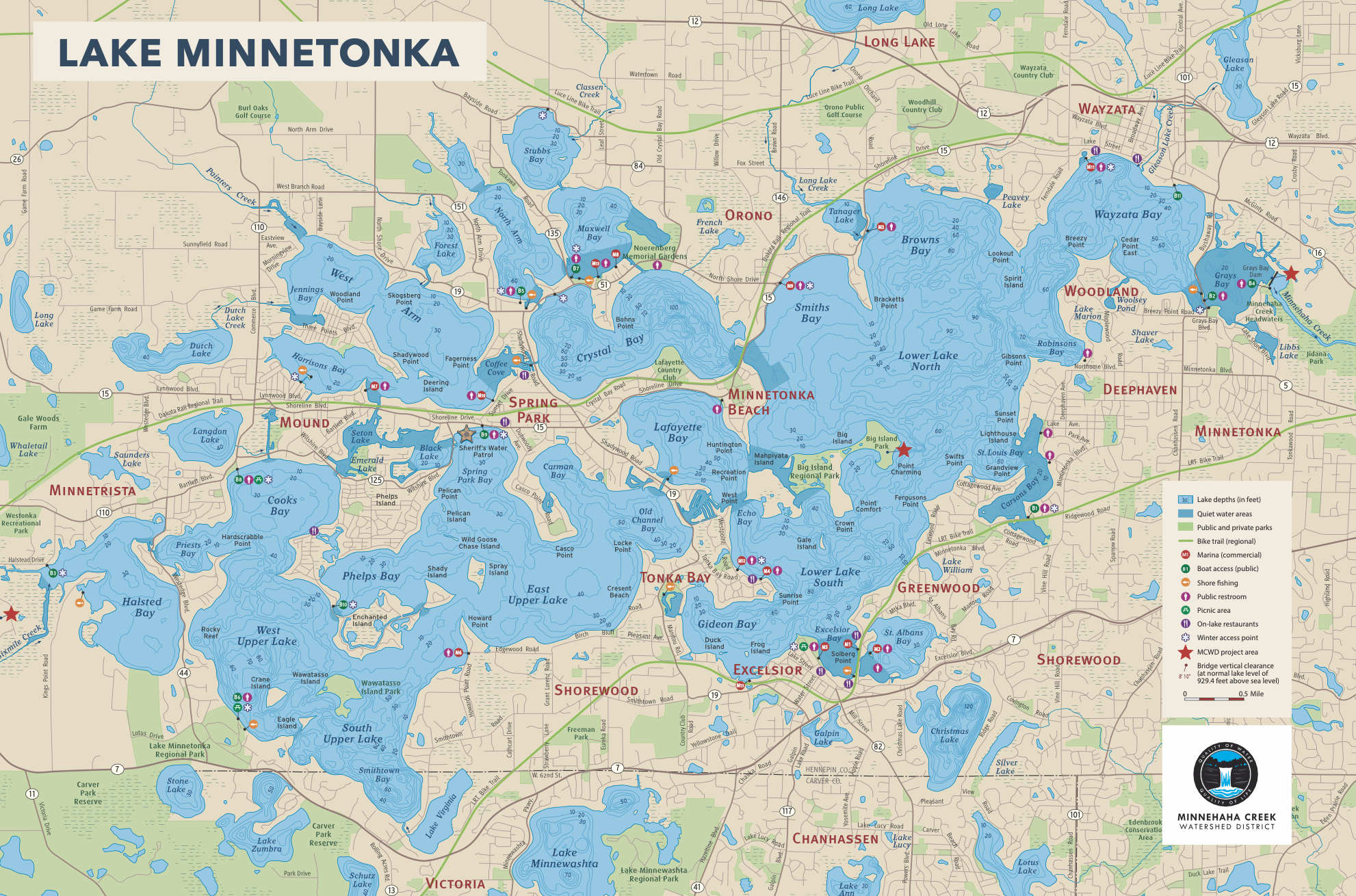
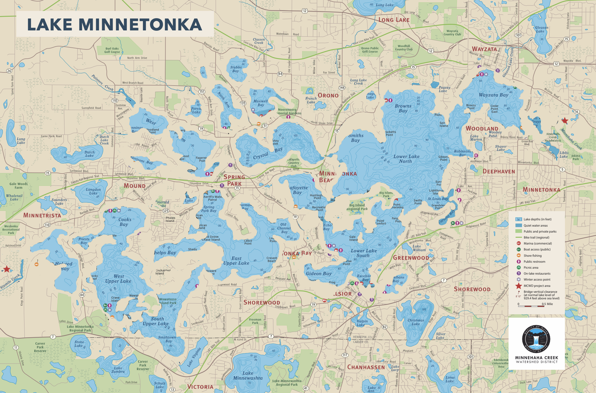
Contrary to popular belief, Minnetonka is not a single, uniform, entity. Rather, it is a woven connection of bays, straights, and islands. Aquatic and land ecology varies across the lake and it’s these differences that contribute to its nature. Each of the lake’s bays can be broken into one of three categories: Lower Lake, Upper Lake, and the Northern Bays. The Narrows Channel is famously the dividing line between Lower and Upper Lake. Upper Lake, to the west, consists of all bays from Carman’s to Halstead’s, including Smithtown, Cook’s, Spring Park, and other connecting bays. Meanwhile Lower Lake consists of bays from Lafayette to Gray’s, including Excelsior, Gideon’s, Saint Louis, and the others. The Northern Bays are categorized by those more removed and lying to the northwest. Those being Crystal, Maxwell, North & West Arm(s), Harrison’s, and their connected bays. They are also the most “forgotten” of the three categories, in that the title of Northern Bays isn’t nearly as common in the public’s vernacular as Lower & Upper Lake.
Like many lakes in the Midwest, Minnetonka was formed through a process known as glaciation. This is the geological process where land is covered by ice glaciers which, over thousands of years, recede and progress across the terrain. Over the last geological epoch the Minnesota region has been subjected to four separate glacial periods, of which, all would cross the Minnetonka area. While they were all important in forming the greater terrain of our state, the last two would be the most impactful to the lake’s formation.
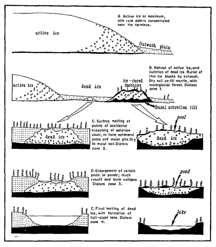
The image above is a helpful descriptor of how lakes are formed as an active ice glacier recedes and leaves behind trapped water pockets and dead ice. It also depicts the sedimentary deposits that can be deposited from within melted ice.
Some twenty thousand years ago, during the last ice age, both of the two final glaciers would creep across the landscape and deposit sediments from far away lands. The first of them, known as the Wisconsin drift, deposited reddish yellow sediments, coppers, and iron from as far north as Canada’s Hudson Bay. Today, these sediments are visible in the south lake area around Excelsior, Tonka Bay, and Gray’s Bay. However, moving northwest through the Narrows, the terrain changes in both its appearance and composition.
After sailing west through the Narrows Channel, the average boater can see the topography change dramatically from Lower Lake’s relatively flat land to Upper Lake’s steep hills and sharp descents. This difference was created by the presence of the second glacier, known as the second Wisconsin drift. As it receded, this glacier deposited grayish sediments and covered the terrain from the Narrows Channel to Halstead’s Bay. Over time, the glacier receded and descended upon the area several times and carved down into the soil. Upon its finial recession, it left behind large sediment deposits which helped form the dramatic topography that can be seen in areas such as Casco Point, Palmer Point, and Smithtown Bay. In some areas, the glacial till can be as deep as 285 feet before reaching the natural limestone bedrock!
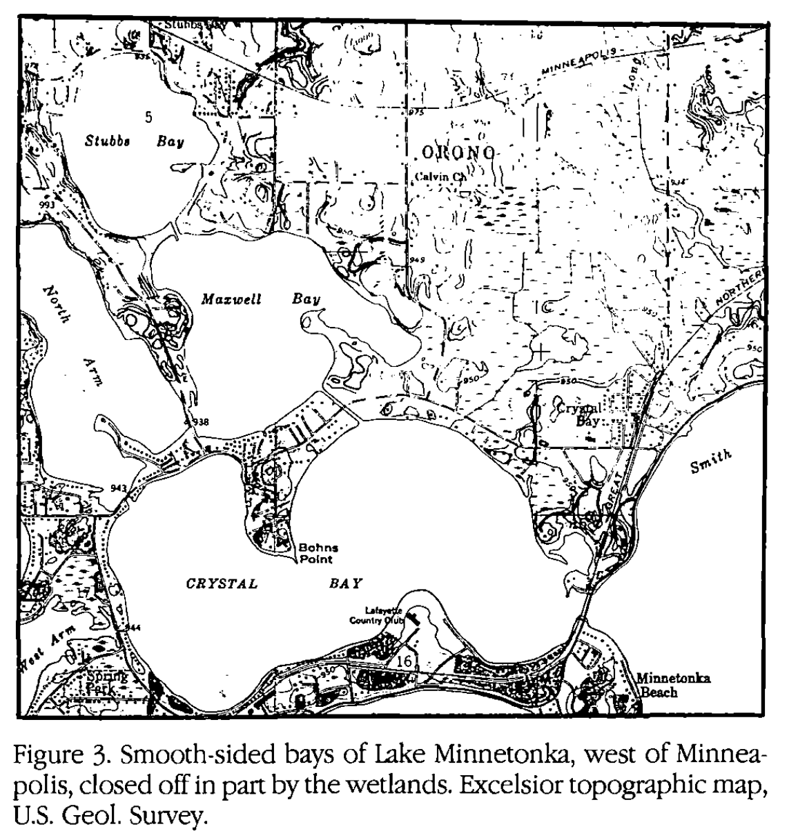
The terrain surrounding the Northern Bays of Minnetonka are a prime example of continued lake formation after the full recession of a glacier. Lakes continue to evolve through sedimentation and erosion, which can be seen by the deposited sandy shorelines around, in particular, the south and east sides of Maxwell Bay and Crystal Bay. This sand can also be transported by waves to deeper waters, creating sand bars and sudden shallows.
In addition to shaping the land the glaciers also, naturally, formed the lake basin. Originally, a number of “bays” had no natural outlet which actually created a series of smaller lakes that would be connected by man thousands of years later. Areas such as Lost Lake, Coffee Channel, Seton Channel, and more had to be dredged to connect the lakes together to create the Lake Minnetonka we know today. Below the lake’s bottom, there is a thick base of impervious clay that forms a sort of “bowl” beneath Minnetonka and extends out into its larger watershed. The watershed of Lake Minnetonka is upwards of six times its surface size, which brings substantial water into the lake after each rainfall. Since precipitation cannot penetrate the clay sub-base, it is forced to emerge into the lake from below in the form of springs. If you’ve ever been swimming and felt a cold blast from below, you’ve treaded over one such spring!
Originally, Minnetonka’s natural outlet was in Gray’s Bay via Purgatory Creek which flowed into the Minnesota River but, as sediments and other changes blocked it, the lake began flowing out via Minnehaha Creek and then to the Mississippi River. Today, essentially all water in Minnetonka flows toward Gray’s Bay. While the average water level today is roughly 928.6 feet, in the days before a controlled dam, water levels varied wildly. In 1937, for example, the lake dropped roughly eight feet after several drought years and would be enough to almost completely dry up at least a handful of channels across the lake, while significantly reducing the size of several bays.
The map below shows roughly what the lake would have looked like under such an intense drought. The upper map is the standard lake while the lower was created by the Minnetonka Minute for purposes of illustrating the drought’s effect on the shoreline. This illustration is, by no means, a perfect one but will get the idea across.
While the lake has undergone many changes over tens of thousands of years, it has undergone the most rapid change within only the last 170 years. This, of course, is change brought by human interference. The dredging of bays, channels, marshes, etc. has created a more interconnected lake. Meanwhile, on shore, the effects of logging, agriculture, development, and unintended runoff pollution has created a noticeable change to the lake’s ecology and water quality. Of course, through decades long efforts by organizations like the LMCD, DNR, and Freshwater Society, much damage has been mitigated or slowed.
In the modern era, it's easy to think of Lake Minnetonka as a static, unchanging, lake. Yet, this is far from the case. Droughts and floods can happen, land erodes, and aquatic species are under constant threat from invasive species and human interference. Minnetonka is very much alive and evolving under our noses. Understanding where it came from will help point toward where it’s going. As sediments move and water changes course it will, likely in many thousands of years, be reduced to a series of shallow swamps and trickling creeks. Today, however, it is an excellent example of the state’s ten thousand lakes and continues actively shaping our community into the future!
Bibliography of Sources:
H.E. Wright Jr, Origin & Developmental History of Minnesota Lakes v55 #1 article 5, 1989, University of Minnesota https://digitalcommons.morris.umn.edu/cgi/viewcontent.cgi?article=2610&context=jmas
Gimmestad Melvin, Historical Backgrounds of Mound, Minnesota, 1964, p. 3-10
Jones Thelma, Once Upon a Lake, 1957
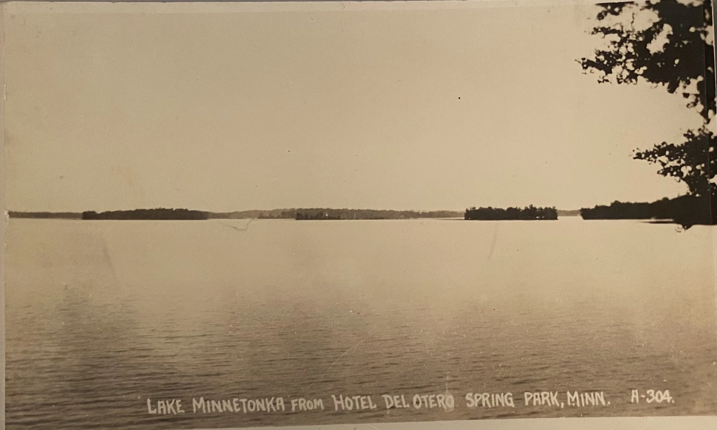
Header Image RPPC, Private archive of the Minnetonka Minute
Drought map created by Nathan Hofer for use with the Minnetonka Minute. 06/2025.